
Customized solutions for risk assessment.


Innovative software solutions that transform complex geospatial and climate data into actionable insights — enabling organizations to analyze risk, run scenario analyses, model impacts, and inform decisions.
Expert advisory and custom modeling services that combine advanced methods — including agent-based modeling of systemic risks, cascading impact analysis, and bespoke geospatial workflows — to help institutions navigate uncertainty and build resilience.
OUR OFFERINGS
Find a solution that works for you.

TerraTab democratizes access to geospatial data and operations, bringing the power of complex spatial analysis to familiar spreadsheet interface.
-
TerraTab provides a singular familiar software for business analysts, consultants, and other business lines to deal with geospatial data.
Spreadsheet for all business lines
Has built-in data and formulas Canada-specific requirements
Everything is accessible via spreadsheet formulas
Supports multi-point geocoding across different asset types with varying sizes based on regional statistics
Completely local, with no data transfer to our servers

Local desktop application for end-to-end physical climate risk scenario analysis using publicly available data. Local, secure climate risk assessment without costly platforms.
-
TerraScen lets institutions run complete physical climate risk analyses using only publicly available hazard data and damage functions — without costly data platforms.
Map portfolios to trusted public datasets to assess exposure
Estimate asset-level damages and financial impacts with publicly available damage functions
Local execution on end-to-end desktop application ensures privacy and compliance
Expert consulting and innovative tools for climate risk assessment, geospatial analysis, and systemic risk modeling to help your organization build climate resilience.
-
We partner with clients to design bespoke solutions that integrate climate science, risk modeling, and geospatial analytics — enabling evidence-based decision-making, strategic planning, and regulatory alignment.
Agent-based modeling to simulate interconnected behaviours, risk transmission, and system-wide outcomes.
Physical and transition risk scenario analysis and stress testing tailored to portfolio, sector, or regulatory requirements
Custom geospatial workflows that align with internal data, operational constraints, and reporting needs
Data augmentation from satellite remote sensing and other external sources to enhance analytical depth and precision
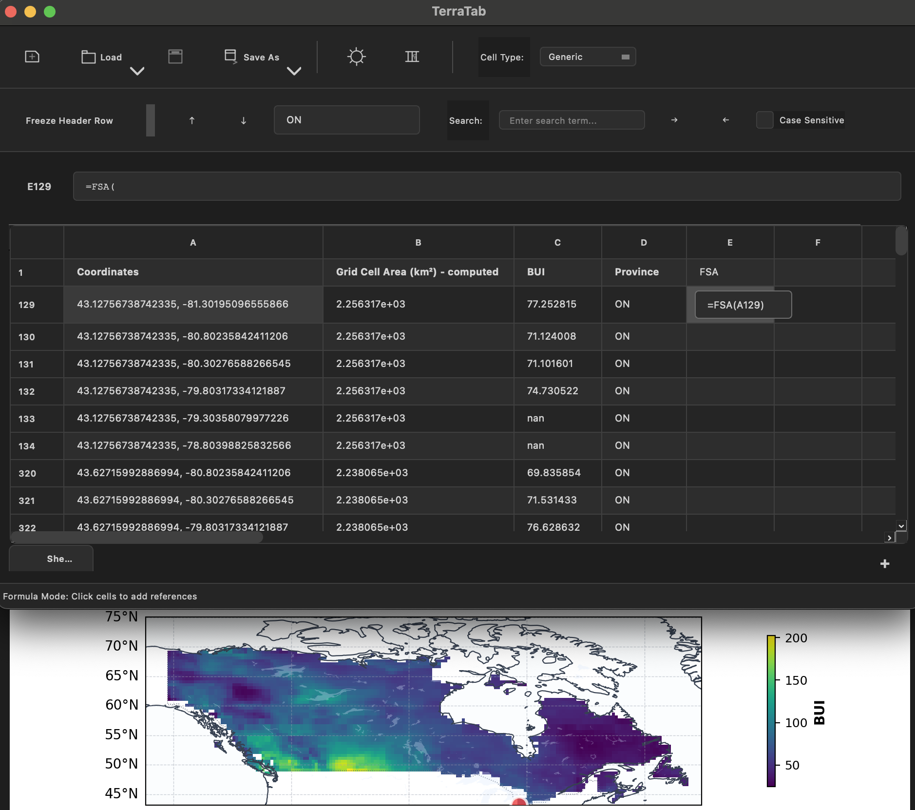
TerraTab democratizes access to geospatial data and operations. Given that most analysts are most comfortable with spreadsheets, TerraTab provides a familiar interface for not just dealing with geospatial data through spreadsheets, but also using spreadsheet formulas and operations to perform custom geospatial operations required by the new era of climate risk assessment.
Existing Solutions
✗ Limited to GIS experts
✗ No built-in integration for Canada-specific regulations and data
✗ Requires coding to accommodate specialized operations
✗ Limited support for region-specific multipoint geocoding
✗ Hosted on servers and relies on cloud solutions
TerraTab
✔ Spreadsheet for all business lines
✔ Built-in data and formulas Canada-specific requirements
✔ Everything is accessible via spreadsheet formulas
✔ Supports multi-point geocoding across different asset types with varying sizes
✔ Runs locally, with no data sent to our servers
TerraTab
TerraTab provides a singular familiar software for business analysts, consultants, and other business lines to deal with geospatial data.

TerraScen
TerraScen empowers institutions to run end-to-end physical climate risk scenario analyses without relying on expensive data platforms or external services. Built around publicly available hazard maps and damage functions, TerraRisk turns raw climate data into actionable financial insights — all locally, securely, and cost-effectively.
Existing Solutions
✗ Rely on expensive subscriptions to proprietary climate data platforms
✗ Depend on cloud infrastructure and external data pipelines
✗ Choice of data and models restricted to vendor's framework
✗ Offer limited transparency
TerraScen
✔ Uses publicly available data with no costly data subscriptions
✔ Runs locally, ensuring privacy and security
✔ Choice of multiple public data sources and frameworks to choose from
✔ Full transparency
CONNECT WITH US